Funding for the PTC Tradition and Technology Project continues to make a difference by providing an opportunity for Fijian youth educated in geospatial technologies to engage directly with communities and seek home-grown solutions to long-standing problems.
Muanivatu Settlement is a community of indigenous Fijians comprising approximately 150 families on the outskirts of Suva City in Fiji.
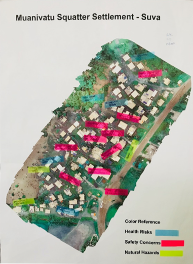
Plate 1: Hazard Map
On 12 March 2018, Pacific Flying Labs in collaboration with the PTC Tradition and Technology Project carried out an aerial survey of the community using drones. This was undertaken as part of a youth engagement with students from local high schools. The outcome of this survey was a Vulnerability Assessment and Hazard Map created by the youths, identifying possible threats that pose harm to the community of Muanivatu.
The settlement of Muanivatu is a 10-minute bus ride from Suva City. Despite being close to Fiji’s major urban center, the atmosphere at the settlement is quite different. This is because of its location, as the settlement is sandwiched between a river that hosts a mangrove swamp and a highway. During very high tides, a good portion of the houses in the settlement are affected by flooding.
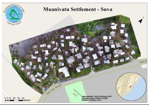
Plate 2: Aerial Map of Muanivatu Settlement Source: University of the South Pacific
On 14 August 2018, a community engagement was held by Pacific Flying Labs in conjunction with PTC Project participants at Muanivatu Settlement. The aim of the community engagement was to share the results of the project with the members of the community, involve them in understanding the results and hazards, and build a relationship and connection between the traditional community and the University.
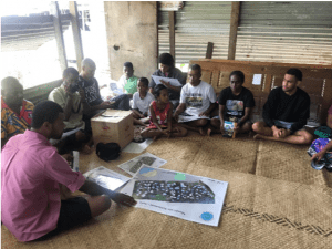
Presentation of Aerial Map Source: Aleen Prasad
A map of the village was prepared and presented to the community headman at the meeting. All of the people, young and old, were thrilled as it was their first time seeing a map of their village from an aerial view.
Once they began to analyze the map, the community headman was able to address matters of concern to their communities’ environment, and we were able to identify future potential projects. The community engagement was a success as it was buzzing with curious questions as to how the community would be able to overcome their environmental challenges with geospatial tools.
Muanivatu has also been pegged as a key site for our village profiling project and community engagement is a core technique in identifying the best possible equilibrium for project objectives so that both the primary and secondary stakeholders are content with the results.
Community Members Analysing the Maps
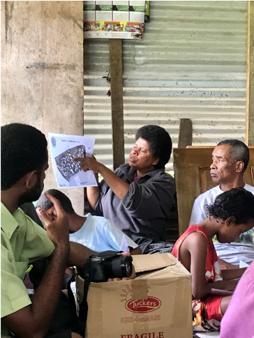
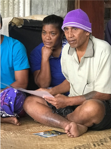
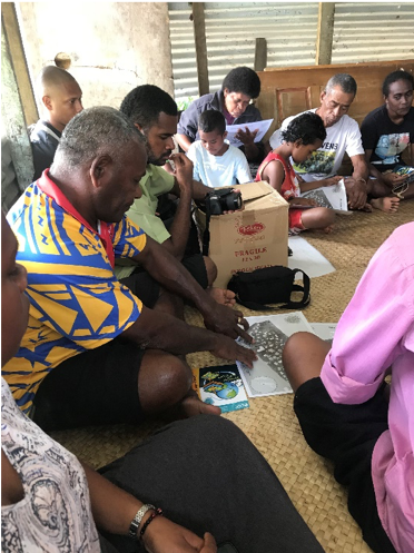
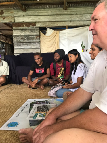
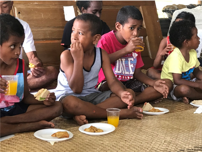
Plate 4: Community Engagement Refreshments
At the end of the meeting, tea and refreshments were provided, and the community members and the students were able to have a conversation and mingle with each other.
For more information about this project, please access the complete report: PTC Tradition and Technology Project by Aleen Prasad and Nick Rollings.